120th Avenue Corridor Study

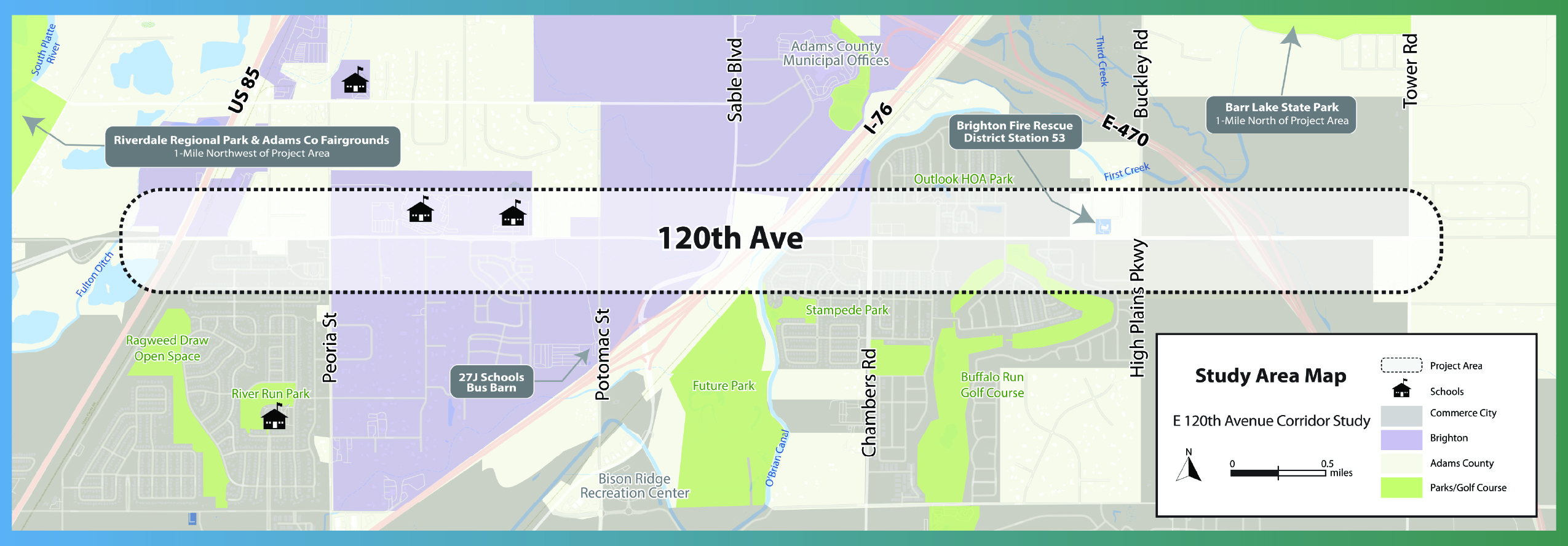
This project produced a conceptual design for future safety and multimodal improvements to 120th Avenue based on an evaluation of existing conditions and community feedback. This has been a collaborative effort between Adams County, Brighton, and Commerce City, who have all identified 120th Ave as a priority corridor requiring investment in existing infrastructure.
The project started in Fall of 2023 and was completed in Summer of 2025.
A list of project goals was developed to help guide the team throughout the study.
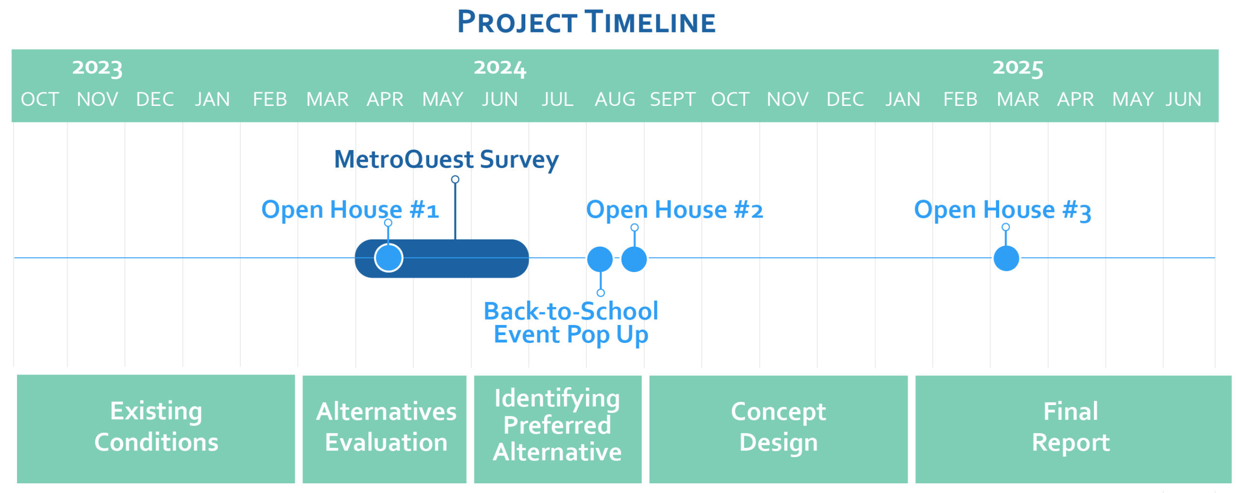

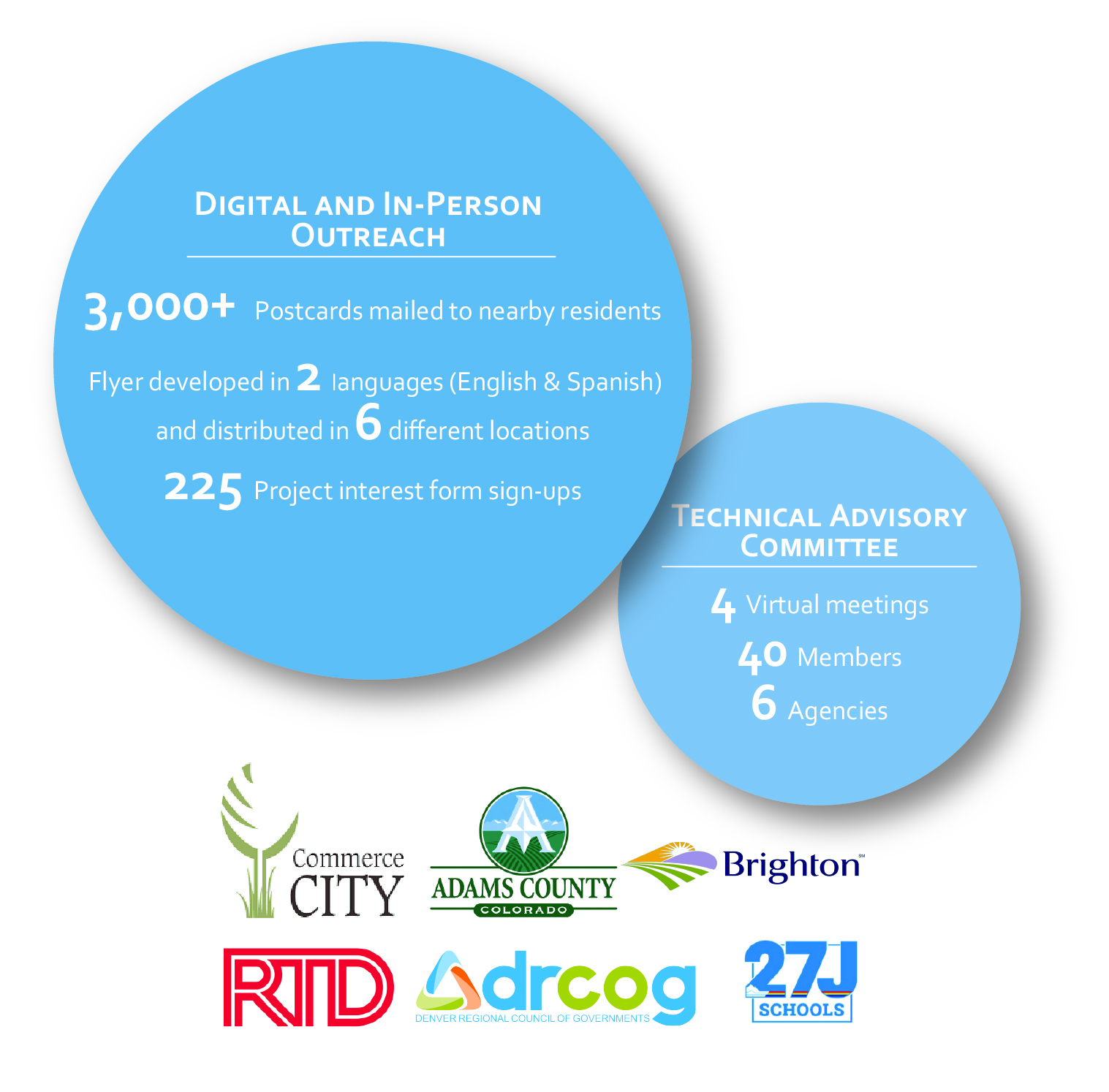
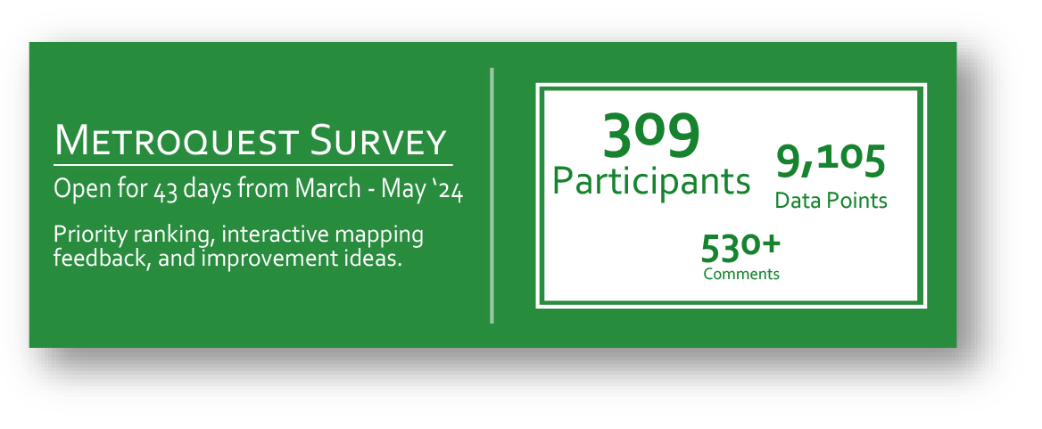
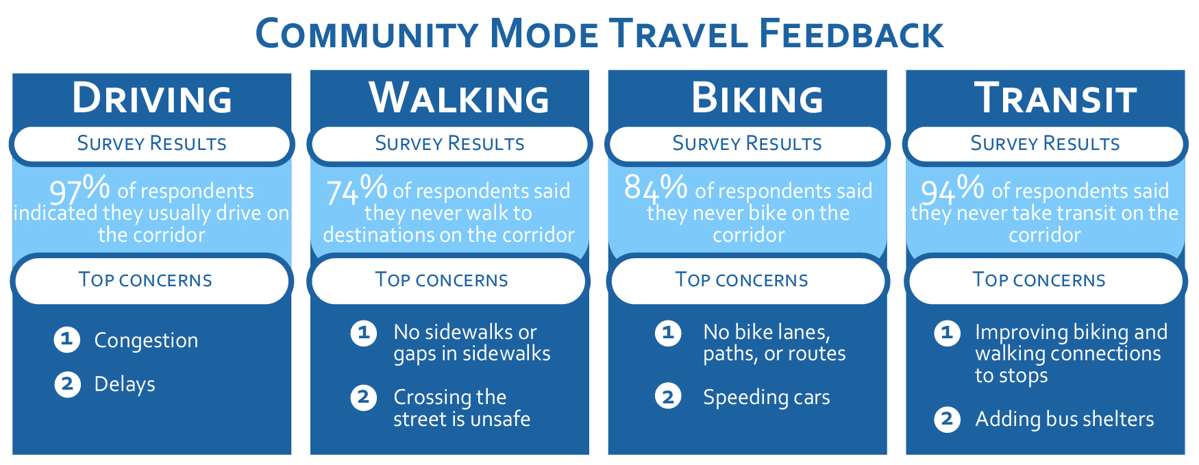
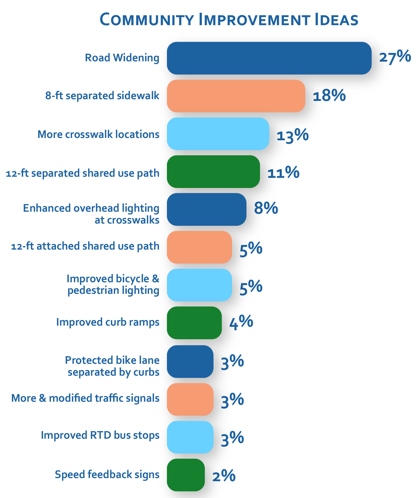
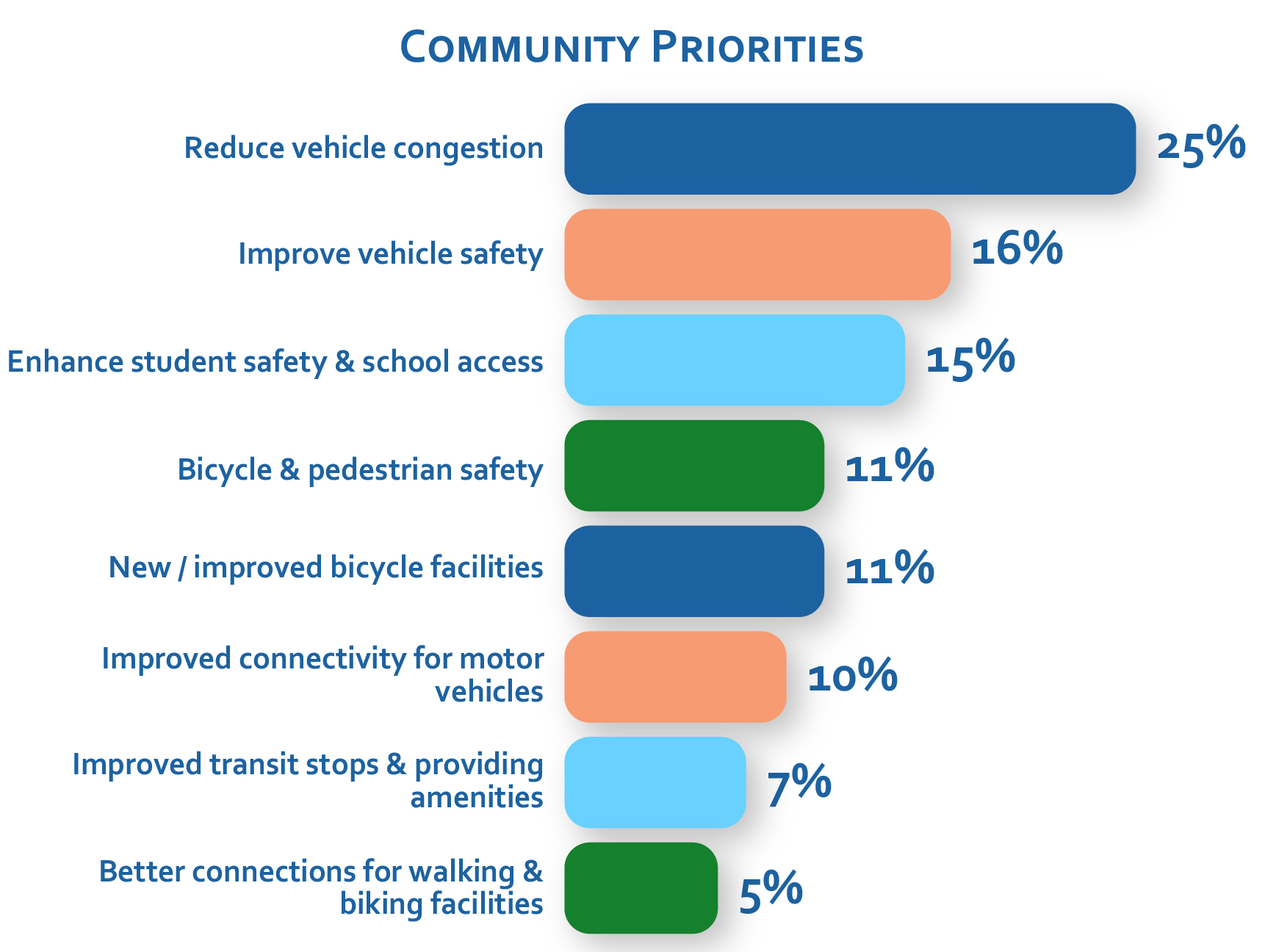
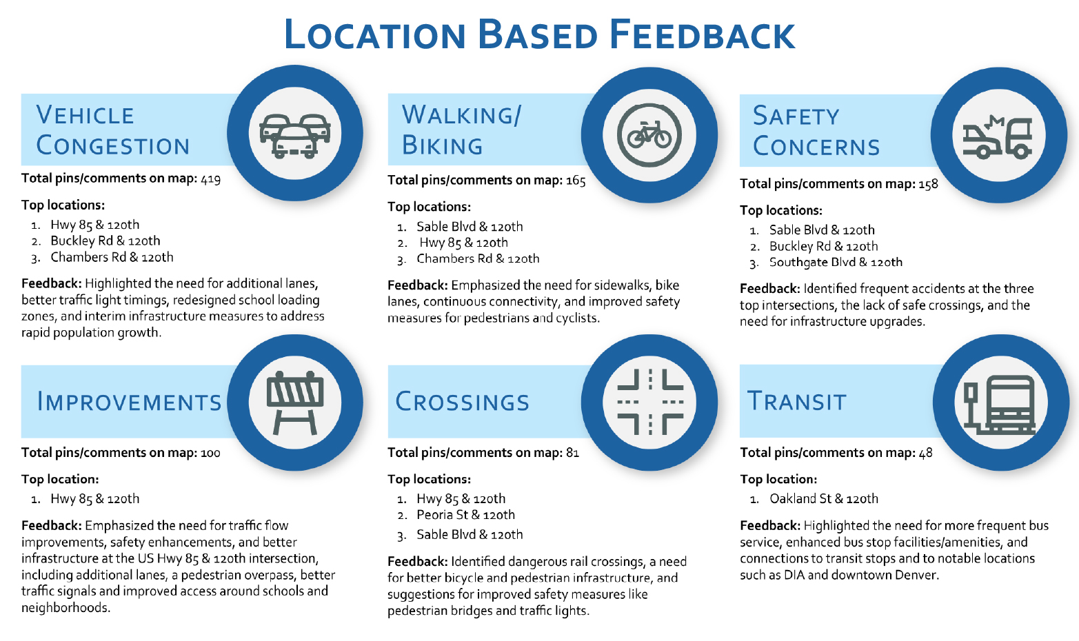
Community member and stakeholder feedback was essential in shaping the project. The project team hosted several in-person engagement events and garnered feedback through several digital surveys. A technical advisory committee (TAC) was also organized and engaged at several key milestones.
The project team used community feedback to evaluate needs and priorities, which then formed the basis for the recommendations and concept design.

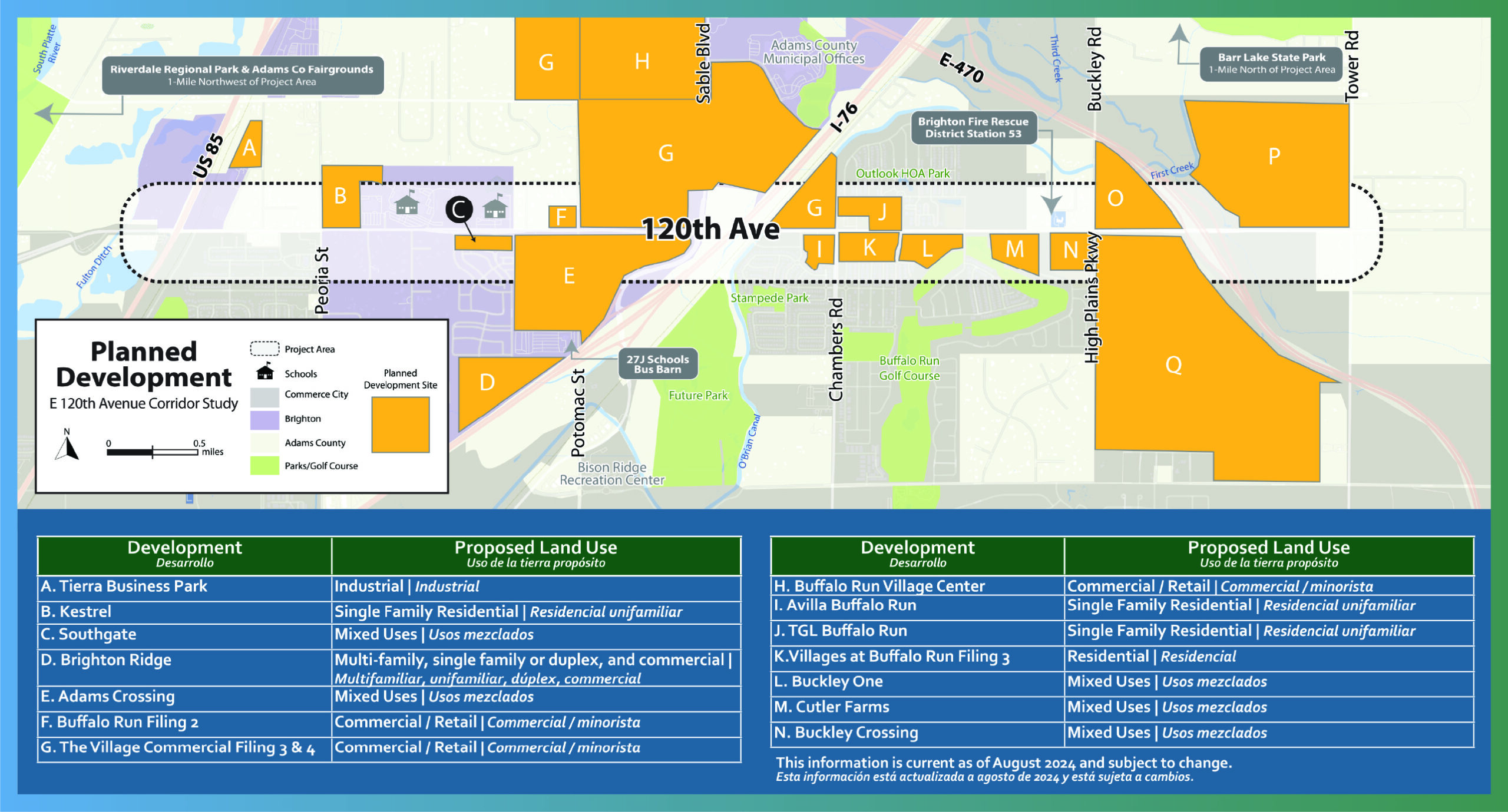
Establishing a consistent vision for the corridor is crucial as new development occurs, leading to substantial growth that will significantly impact the roadway network. Participating agencies will work with developers to implement transportation improvements, such as intersection upgrades, sidewalk enhancements, and access management, to address increased traffic volumes and ensure roadway user safety.

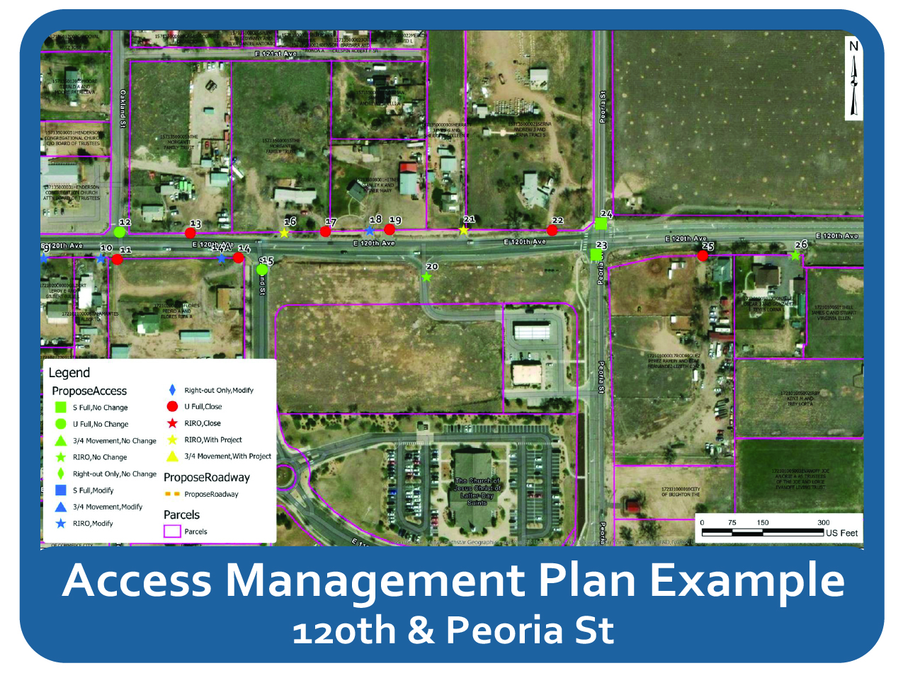
Access management modifications are proposed to enhance safety and improve traffic operations. Roadway improvements for a 2050 traffic analysis were developed and include elements such as new auxiliary lanes, access point closures, and movement restrictions at certain intersections. This analysis was used as the basis for the geometry of the final concept design. To view the complete Access Management Plan for the corridor, please visit the website here.
Utilizing the Envision Sustainable Infrastructure Framework scoring tool, the alternatives were analyzed based on key sustainability and resilience metrics. This marked the first use of the Envision process in a planning study to evaluate the preferred alternatives.


The project team developed three alternatives, then evaluated them using 10 criteria that considered feedback from residents to this point. A detailed description of the criteria and scoring can be found in the Final Report.
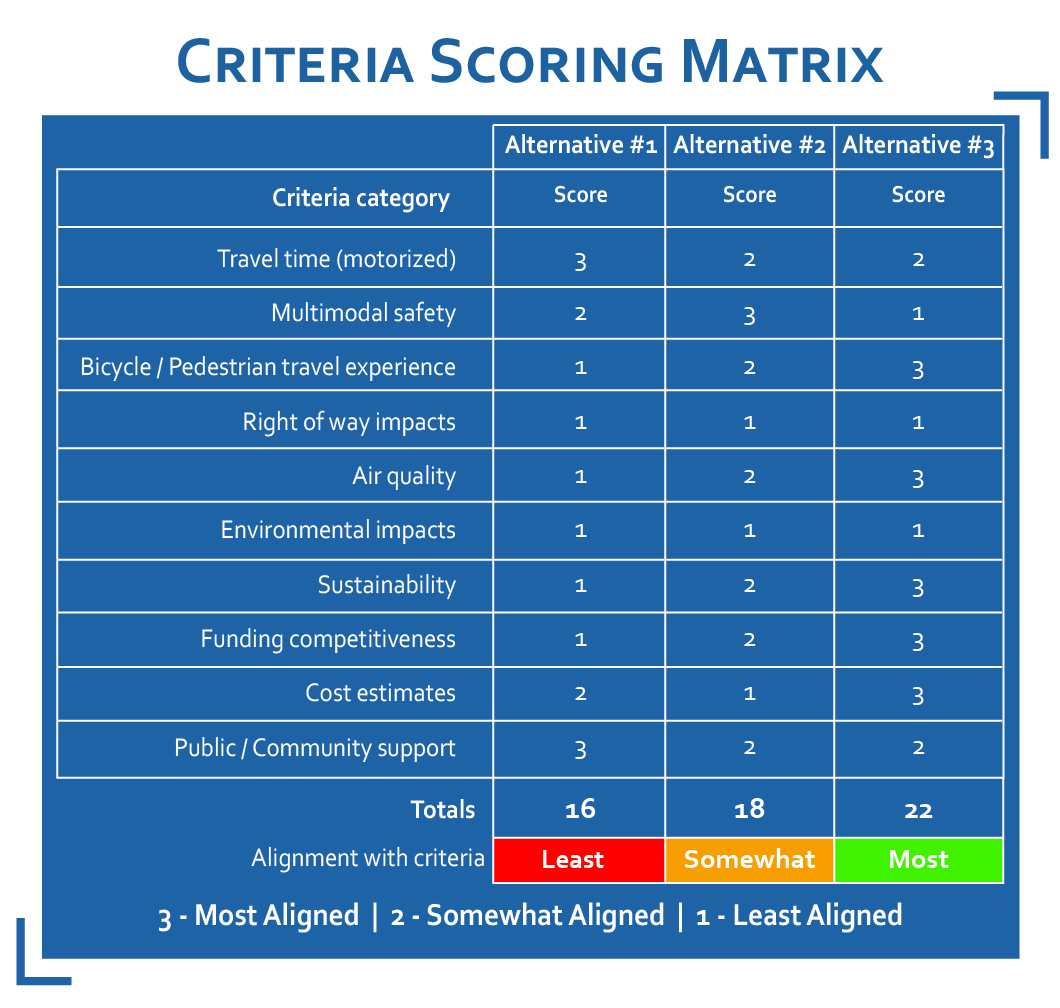
After scoring the alternatives using the 10 criteria, they were presented to the public for voting.
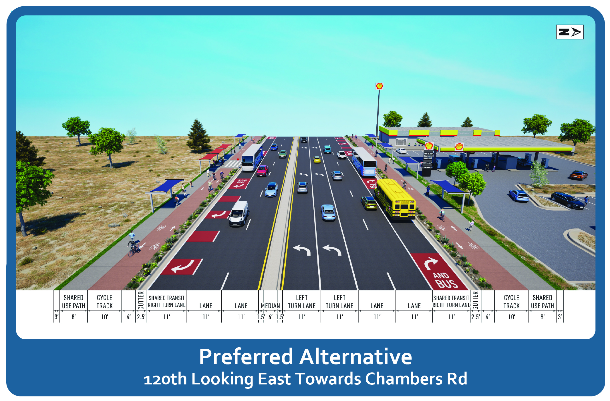
The preferred alternative presented here incorporates key elements from the three alternatives evaluated. It also reflects additional feedback from the Technical Advisory Committee, which helped shape the final concept design. This image illustrates a typical street cross-section of the preferred alternative, highlighting the proposed roadway features. This cross-section represents what the roadway would look like near the Chambers Rd intersection. A similar design would be applied along 120th Ave east of Sable Blvd, while the section west of Sable would differ slightly due to the roadway being 10-ft narrower.

To request the entire concept design, click here.
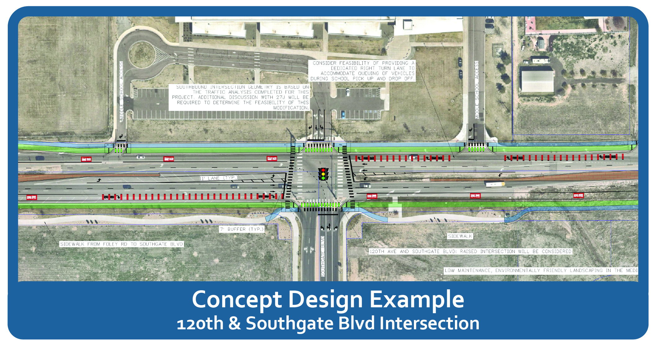
Key design elements were incorporated to address concerns surrounding poor driver and pedestrian behavior, which were identified with the existing conditions analysis. Further discussion and evaluation led to the incorporation of additional features into the concept design, such as traffic calming with raised intersections, adding new traffic signals for better signal coordination, recommending a lower posted speed limit, and modifying the school zone near the middle and high schools.

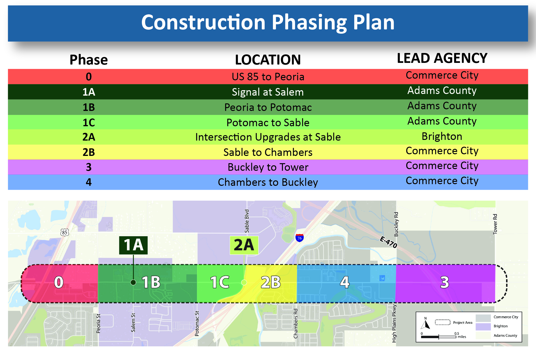
Given the project’s extensive length and probable construction costs, the team identified possible construction phasing and interim improvements, which can be used by partnering agencies as funding becomes available to move forward with 100% design and construction.

Completed in June 2025, the Final Report for the 120th Avenue Safety & Multimodal Corridor Study summarizes the key project outcomes as well as phasing and funding considerations for moving the concept into final design and construction. Report appendices include an existing conditions evaluation, an access management plan, and a summary of community engagement conducted for the project. You can request the following documents by clicking here.
EXISTING CONDITIONS REPORT
ENGAGEMENT OVERVIEW – METROQUEST AND OPEN HOUSE
OPEN HOUSE BOARDS
AUGUST BOARDS
FINAL REPORT